The
OARC (Online Amateur Radio Club) is a free to join radio club, who encourage activity, this was one of those activity days, Organised by an OARC member to encourage SOTA operation and get people out portable operating!
Anyhow, I had originally planned to do
Freeholds top G/SP-011 but somehow, I decided Hail storm would be better. I took some advice off Tom, M1EYP who suggested that the Trig point located at Top of Leach was in the Activation Zone, and makes an ideal activation point apparently the actual summit of Hail storm Hill is a boggy unpleasant mess! Tom also suggested a route to the summit from the village of Cowpe, however I noticed that it was also accessible from Rooley Moor Road AKA The Cotton Famine Road..
Time for a quick History lesson! The Cotton famine road got its name, when, during the American civil war there was a great Cotton Famine during the years 1861 - 1865. most of the mills of Lancashire were either on stop, or short time, and 1000s of mill workers were laid off. in order to receive poor relief men were "employed" to make improvements to the then Catley Lane. a total of 327,600 stone setts were hewn out of the local quarries on the route and laid to form a road. quite a feat! sadly some of the road is now damaged, and the setts stolen but large sections still exist and are open as a bridleway.
Right, back to the activation... I've always fancied a walk up the "Cotton Famine Road" so this was a perfect opportunity! I duly Alerted the activation on the SOTA system, and awaited the day..
The day was a warm, but not massively sunny (my first mistake!) warm enough for shorts (significant later on) so I ditched all my wet weather gear, packed snacks and plenty of water as well as my portable setup and headed up to the start of my walk. I decided to start at Catley Lane Head, parking the car at SD 86954 16092 and essentially follow the yellow brick road up hill from there!
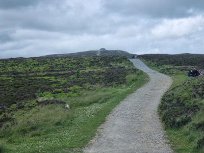
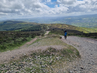
The road surface varies from the yellow stone setts, to sections of none existence where the setts have been robbed out and can be VERY rough in places! interestingly some sections have long stones placed for cart wheels to run along, and still show the grooves of the carts that once plied thier trade over this bleak moor..
There are also some fantastic views down the valleys I was really enjoying this!
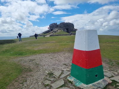
After an hour or so's walking I diverged off the track to find the trig, and located it easily, got setup, spotted and gave a CQ call..
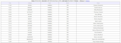
it was pretty Windy up top, so I found a hole in the grass to lie in and get out the wind (mistake number 2). the calls came in fast totalling 17 2E0DIJ being the first. the calls covered a good area, into Cumbria, Lancashire and Yorkshire the best being into Ulverston and near the end a S2S with Peter MW0PJE/P who was on
GW/NW-062 - Hope Mountain. after 50 mins the calls tailed off, and I decided to pack up..
Now, remember from the top of the post, this was supposed to be the OARC SOTA day, so imagine my disappointment at not having an S2S with any other OARC member! that said, it was another SOTA and another Trig in the bag.
Logbook..
The descent was as uneventful as the Ascent, and equally enjoyable except my legs felt a bit funny.. sort of sensitive, i thought it somewhat odd maybe the grass i lay in had irritated my skin.. very odd!
it wasn't
until i got home, and realised my 2 mistakes! Balls, BURNT LEGS!!
these were sore for the best chunk of 2 weeks... Lessons learned!! Sunblock and not lying in the sun!
Another Great afternoon out, as ever thanks to the chasers and fellow activators always makes my day to see the contacts rolling in!
Cheers, Alan de 2E0JWA


